Integrating Paleoecology and Time-lapse Technology in an Elevator

I love when my interests align in a brilliant example of integrating paleolandscape reconstructions, human ecodynamics, and technology for public consumption — this time in the guise of a time-lapse video on an elevator ride.

Five elevators which will be servicing the observatory atop the new 1 World Trade Center (in NYC) will show a 47-second video time-lapsing 515 years of panoramic landscape change along the tip of Manhattan Island. What a brilliant documentary and concept!

55-feet below ground, visitors begin in 1500AD. At 250 feet they reach 1760AD — the British Colonial Era. By the time they reach 1,269 feet above ground, visitors have seen skyline landmarks come and go.

For more information visit the original article at: http://www.nytimes.com/2015/04/20/nyregion/on-time-lapse-rocket-ride-to-trade-centers-top-ghostly-glimpse-of-doomed-tower.html?smid=fb-share&_r=1
Fun at Conferences: Chicago Public Transport Edition

Almost every year that I’ve made the pilgrimage to the annual Association of American Geographers (AAG) meeting, I’ve used public transportation to get around – Chicago is no exception. The exception, this time, was that I managed to get turned around upon arrival, as opposed to a few days in (really? Who puts the north AND southbound buses at the SAME STOP. Facing the SAME DIRECTION. With the same text on their display. At night. In the rain? That’s just asking for it).

So 20 minutes in to going the wrong way on the bus, I use my handy-dandy Google Maps app to see how much farther until I need to request a stop (the app had said ~27 minutes to my destination when I got on). That’s when I discovered I was going southbound Continue reading “Fun at Conferences: Chicago Public Transport Edition”

Android Geography Apps – My List

It’s been quite a while since I posted. Unfortunately, I’ve been spending most of my time away from technology and instead learning about paleoenvironmental research methods for my dissertation research.

Fortunately, a friend of mine just got an Android phone (whoop!!!!) and asked me what apps I suggest he install. No time better than the present to pull out my phone and take a look at the apps I use most often, and the ones I’ve installed but have yet to play with.

Geography apps (in alphabetical order) Continue reading “Android Geography Apps – My List”

EarthObserver App

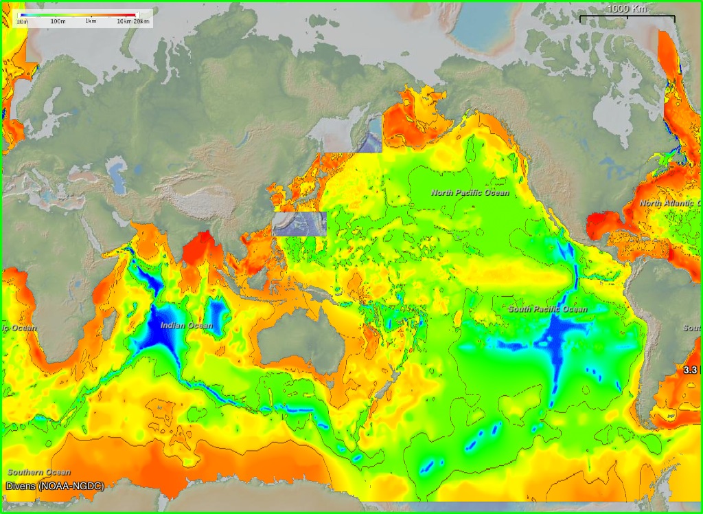
Released in the last few weeks, the EarthObserver mobile app lets you interact with geology, climate, underwater, sonar, atmospheric, etc. data once only available to earth scientists. There are three projections to choose from: Mercator, North Pole, and South Pole. Map resolution ranges from 4-30 meters, and an info button gives you access to data sources and citations. You can even take a screenshot within the app. EarthObserver was created by Columbia University’s Lamont-Doherty Earth Observatory, and looks absolutely amazing.

Ocean Sediment Thickness

http://www.earth-observer.org/

Unfortunately, I do not own an iPhone, iPad, or iPod. However, those of you who do can now access what appears to be a pretty darned cool app on your mobile device. The rest of us will have to settle for “companion software” on our Macs/PCs. I’m hoping an Android version will be available soon =). What are your thoughts?