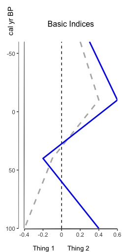
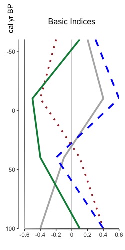
That’s right, you heard me. You can now overlay multiple indices on one plot. Why? Because sometimes appending graphs just isn’t good enough and you really need to overlay two index datasets (or more) to see that relationship between them. The tutorial for how to do so is now available, and it leverages all the same styling options as plotting an index. Here’s a sneak peak of two different overlaid plots: one reasonable one with two datasets, and another to show that you can put multiple one one graph. I don’t know why you’d want to do that, but I figured “hey, why not”.
apps
Technology in the Field: Smartphones
Once upon a time (back in 2011) I wrote an article on the accuracy of smartphones in the field compared to dedicated GPS units (click here to read it). Coming back from the field has reminded me that nothing’s changed — I’d still rather use my phone than wait for the GPS unit to power up and figure out where I am.
There’s plenty more GPS apps for smartphones now than there was 5 years ago, but I still find myself consistently going back to Maverick (Play Store). It’s simple, lets me drop my waypoint, take a georeferenced picture, add in descriptions, and makes me happy. Used to use OruxMap (Play Store). It has great features, but for some reason I just click on Maverick for fast fieldwork.
It’s nice to see people getting on board with smartphones as GPS, from geography field trips (article) to research investigations (article). Not nearly the backlash when I presented at conferences oh so many years ago (*gasp*! How DARE you say some PHONE is as good as a $2000 Trimble?!??).
Android Geography Apps – My List
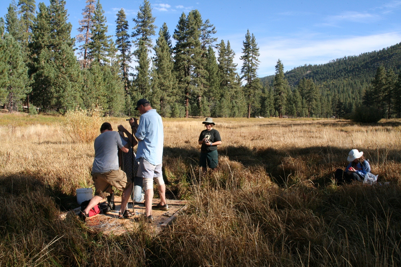
It’s been quite a while since I posted. Unfortunately, I’ve been spending most of my time away from technology and instead learning about paleoenvironmental research methods for my dissertation research.
Fortunately, a friend of mine just got an Android phone (whoop!!!!) and asked me what apps I suggest he install. No time better than the present to pull out my phone and take a look at the apps I use most often, and the ones I’ve installed but have yet to play with.
Geography apps (in alphabetical order) Continue reading “Android Geography Apps – My List”
EarthObserver App
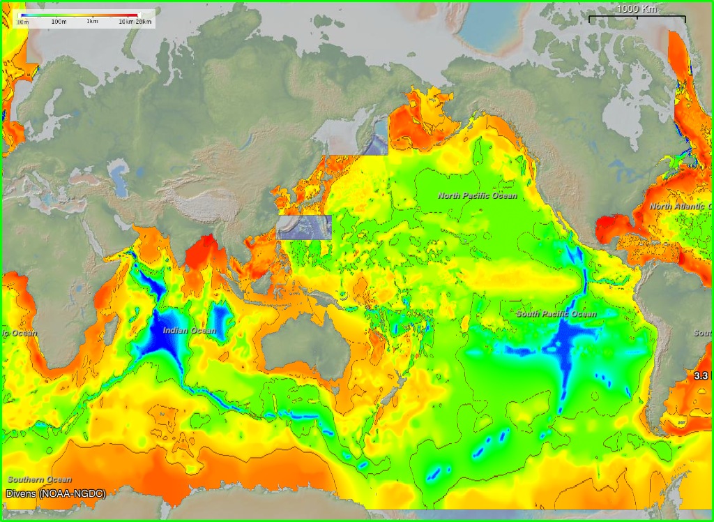
Released in the last few weeks, the EarthObserver mobile app lets you interact with geology, climate, underwater, sonar, atmospheric, etc. data once only available to earth scientists. There are three projections to choose from: Mercator, North Pole, and South Pole. Map resolution ranges from 4-30 meters, and an info button gives you access to data sources and citations. You can even take a screenshot within the app. EarthObserver was created by Columbia University’s Lamont-Doherty Earth Observatory, and looks absolutely amazing.
http://www.earth-observer.org/
Unfortunately, I do not own an iPhone, iPad, or iPod. However, those of you who do can now access what appears to be a pretty darned cool app on your mobile device. The rest of us will have to settle for “companion software” on our Macs/PCs. I’m hoping an Android version will be available soon =). What are your thoughts?
App Review: c:geo
I’ve recruited my 4-year old daughter to go “treasure hunting” (aka geocaching) with me. I’ve tried GeoBeagle before, with varying degrees of success. Usually I just get the cache info in GeoBeagle and input it as a waypoint in Maverick. Most recently I’ve been playing with c:geo, and find it to be much better (and cheaper. I’ll get to that later).
C:geo is more of a stand-alone application than GeoBeagle (or any other Android app I’ve tried). Like other geocaching apps, c:geo works with geocaching.com. Unlike GeoBeagle, you do not need a premium (ie: paid) geocaching.com account to download and store caches on your phone — c:geo will let you cache the locations directly. You can do this by inputting a geocode, lat/long, address, keyword, username, near you, live map (awesome feature), etc.
In addition c:geo can navigate you to the cache using Google Maps (great if you’re driving, as you get voice navigation as well), radar (have GPS Status installed), or compass. In a way, getting to the cache is almost too easy. And considering other accuracy validation I’ve done (which will be presented at the 33rd Applied Geography Conference in October 2010), I know the G1, and Droid Incredible, can navigate there within the apps’ reported accuracy.
Overall, if you’re looking for a really good, feature-packed, free geocaching app, I’d recommend c:geo. One caveat. I couldn’t manage to log in with c:geo until I re-downloaded and signed in with GeoBeagle. Only then would c:geo successfully log in. If you have a problem registering c:geo with geocaching.com, I suggest this work around. Happy caching!


